Isolated heavy rainfall is likely over Telangana on 3rd July; Kerala & Mahe, Interior Karnataka during 3rd-6th July, Coastal Karnataka during 3rd-9th July with very heavy rainfall over Kerala and North Interior Karnataka on 03rd; Coastal Karnataka on 4th & 05th and South Interior Karnataka on 4th July
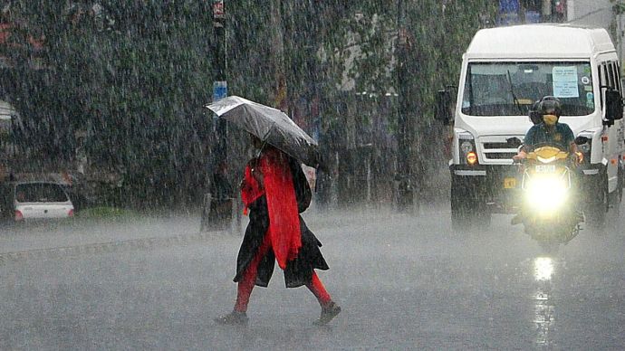
According to the India Meteorological Department (IMD), the national capital Delhi may remain partly cloudy today and there is a possibility of very light to light rain with thunder and lightning at some places. This weather system remains due to the active monsoon trough in many areas of North and East India.
According to the latest report of the Meteorological Department, the monsoon trough formed at sea level is currently extending to the east-central Bay of Bengal passing through Bikaner, Vanasthali, Shivpuri, Singrauli, Chaibasa and Digha. Along with this, another trough line has formed from southeast Rajasthan to northwest Bay of Bengal, which is passing through the central part of Madhya Pradesh, North Chhattisgarh and South Jharkhand and adjoining areas. This trough system extends from 0.9 km to 5.8 km above sea level and is tilted towards the south with height.
The effect of these active weather systems may increase convective activities during the day in Delhi and its surrounding areas, which is likely to cause light rainfall.
The monsoon system is likely to become more effective in North and Central India, which may increase the intensity of rain in Delhi in the coming days. However, there is no possibility of heavy rainfall at the moment. The Meteorological Department has warned citizens to be cautious during thunder and lightning and stay away from open spaces.
Heavy rains are expected at many places in Kerala till July 5 (Saturday). According to the Meteorological Department, if there is rainfall of 64.5 mm to 115.5 mm in 24 hours, it is classified as heavy rainfall.
The India Meteorological Department (IMD) on Monday also warned of heavy rains in Goa and declared a ‘yellow alert’ for the state till July 7.
Light to moderate rainfall is expected across most parts of Northeast India over the next 7 days, accompanied by thunderstorms and lightning. Isolated heavy to very heavy showers are also likely, with extremely heavy rainfall (≥21 cm) forecast over Meghalaya on July 6.
Isolated heavy rainfall is expected over Himachal Pradesh, Uttarakhand, East Rajasthan, and Punjab from July 3rd to 9th. East Uttar Pradesh and West Rajasthan are likely to experience heavy rain from July 3rd to 5th, while Haryana, Chandigarh, and West Uttar Pradesh may see rainfall during July 5th to 9th. Jammu is forecasted to receive rain between July 5th and 8th. Very heavy rainfall is anticipated in Himachal Pradesh from July 5th to 7th, in Uttarakhand, Punjab, and Haryana on July 6th and 7th, in East Rajasthan from July 4th to 6th, and in West Rajasthan on July 3rd.
Telangana to receive light to moderate rains accompanied by thundershowers, likely to occur at isolated places in Telangana.
Heavy rainfall is expected over the next 24 to 48 hours, along with thunder, lightning, and strong winds. Residents should stay cautious.
#watch | Heavy rains caused severe waterlogging in Rajasthan's Ajmer yesterday pic.twitter.com/9FQDt2IF8Z
— ANI (@ANI) July 3, 2025
Manipur’s orange bowl blends tradition with ecological wisdom#manipur #dailong #orange pic.twitter.com/eqwRmEHXxv
— ANI (@ANI) July 3, 2025
#watch | Rajasthan | Waterlogging caused traffic jams in several parts of Jodhpur city following heavy rains yesterday pic.twitter.com/QVhM5i06Ah
— ANI (@ANI) July 3, 2025